
High-resolution site maps for accurate measurement, analysis, and complete project visibility.
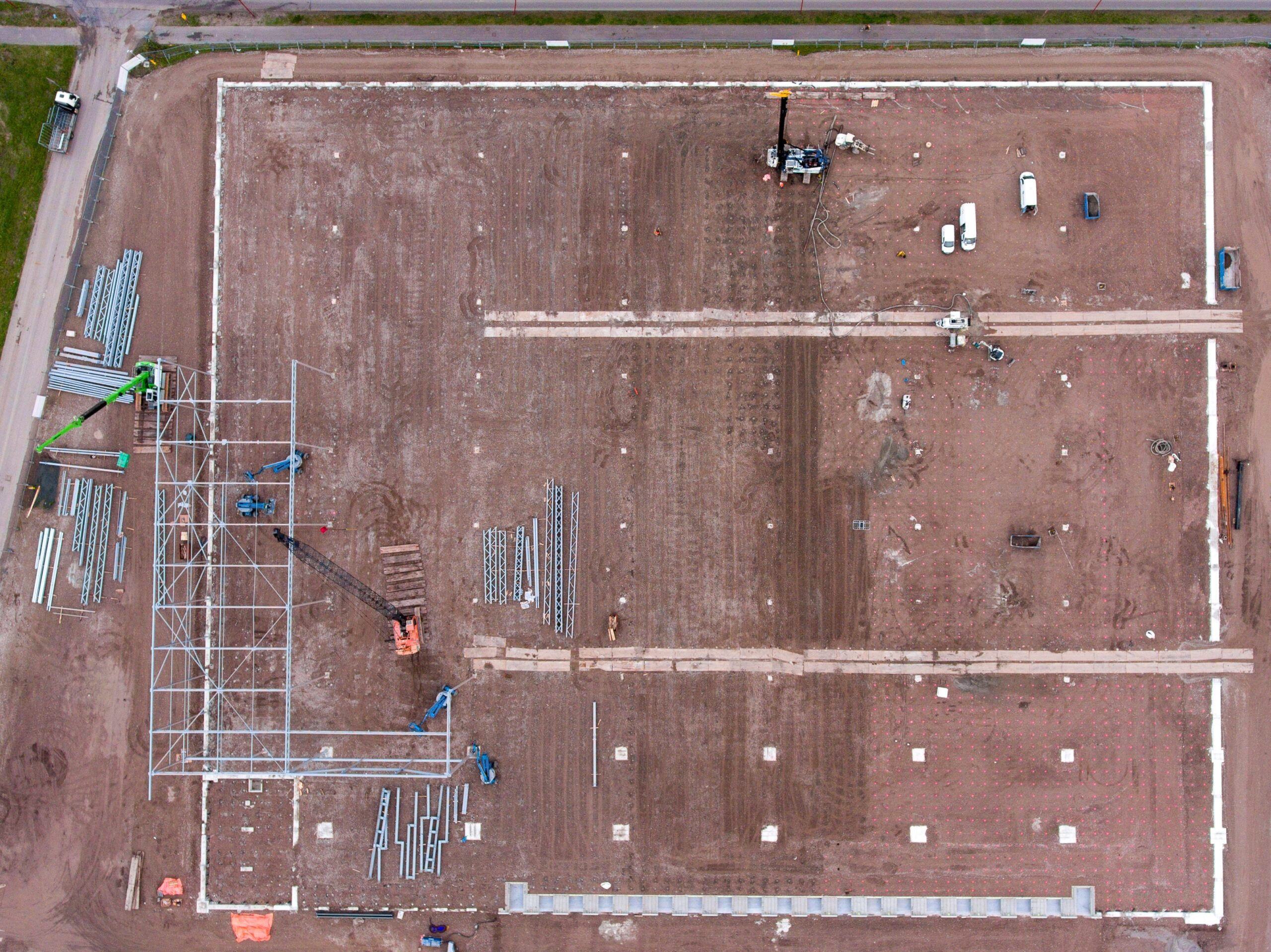
Orthomosaic mapping provides a single, accurate aerial image of your entire project site—created by stitching high-resolution drone images into a scale-corrected map. This allows teams to view the full site at once, zoom into specific areas, and perform reliable measurements without physically being on-site.
While many refer to this service as a drone survey, our focus is on delivering clear, high-quality orthomosaic maps that support planning, monitoring, and informed decision-making.
We deliver orthomosaic maps that combine visual clarity with practical usability.
Scale-corrected aerial maps suitable for site understanding and measurements.
Measure road lengths, plot areas, site extents, and work zones directly from the map.
Easily zoom into site details and share maps with teams and stakeholders.
Professional drone flights planned specifically for accurate orthomosaic generation.
High resolution, scale accurate, measurable
Limited clarity and unreliable measurements
Our orthomosaic solutions are designed to make site data easy to understand and easy to use, even for non-technical teams.
View the entire project area in a single, seamless aerial image.
High-resolution imagery allows you to zoom in and identify site details clearly.
Measure distances and areas directly from the orthomosaic map with confidence.
Use the map for layout planning, coordination, and documentation.
Our project process is built to ensure clarity, efficiency, and smooth progress at every stage. We begin by understanding your goals, then move into structured planning, resource coordination.
We review the project area and understand how the orthomosaic map will be used—measurement, planning, or documentation.
Flights are planned with proper overlap and alignment to ensure a clear and accurate orthomosaic output.
Captured images are processed into a seamless orthomosaic map and delivered in a user-friendly format.
It is a high-resolution aerial map created by stitching drone images into a single, scale-accurate image.
Drone survey refers to the data capture process. Orthomosaic mapping is one of the key outputs used for visualization and measurement.
Yes. Distances and areas can be measured directly from the orthomosaic map.
Yes. The map is high-resolution and allows zooming without losing clarity.
Maps are delivered in easy-to-view formats that can be shared and reviewed across teams.
We specialize in advanced drone operations and aerial data processing that transform complex sites into clear, actionable visual insights.
*Stay updated with our latest projects and industry insights.